|
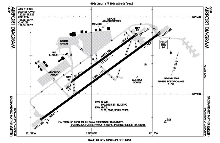
- ICAO code: KMHR
- Location: Sacramento, California,
United States
- Latitude: 38* 33' 18.950"
N
- Longitude: 121* 17' 50.101"
W
- Elevation: 99 ft.
- Runways:
- Runway 4R/22L - heading 37*/217*
- 11,301 x 150 ft.
- ILS rwy 22L - I-MHR - 110.70
- Runway 4L/22R - heading 37*/217*
- 6,040 x 150 ft.
|
Click the above picture for the
airport diagram for KMHR |